
Description
Airspace Converter
Airspace Converter is a handy tool that helps people in the aeronautical industry manage air traffic and set up routes. It's super important because airspaces are key for organizing all that flying around! Most of the time, the data comes in standard formats like OpenAir or openAIP. But here's the catch: these formats don't show up nicely in Google Earth. That's where Airspace Converter steps in to save the day!
Transform Your Files Easily
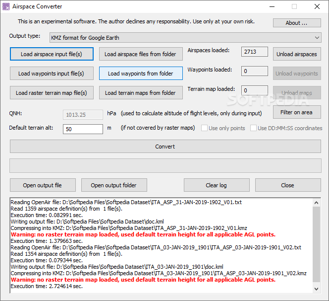
This software lets you change those tricky files into easy-to-use KMZ, Polish, or Garmin IMG formats. This means you can have a great 3D view and do more with your data. You can pick input files, waypoints, or raster files as your starting point. Once you load your airspace data from its source, you'll see how many airspaces you've got ready to go!
User-Friendly Features
If you want to unload some data, no worries! Airspace Converter allows multiple files at once. When you're ready to convert, it'll ask where you want to save those new output files. Plus, there's a status log that keeps you updated on how everything's going. If something goes wrong, errors pop up in red so you can spot them easily—nice and simple!
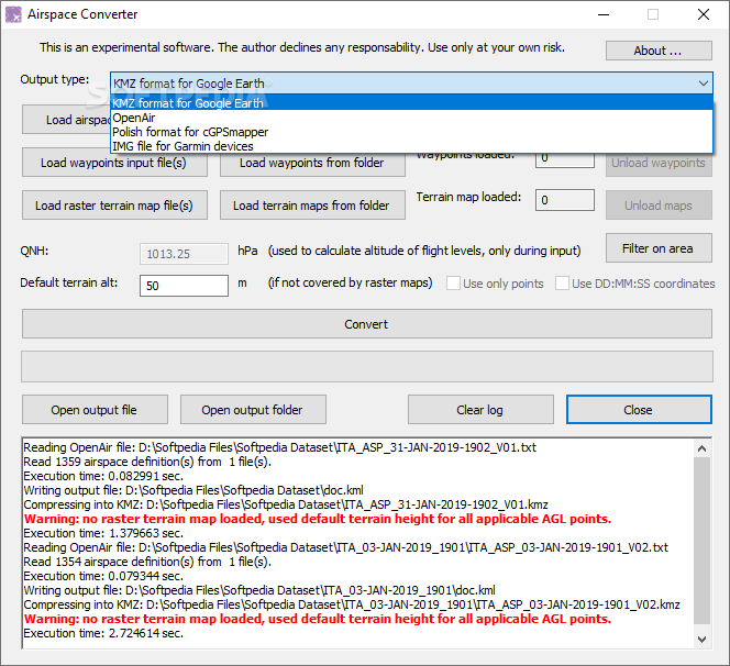
Output Formats Galore
You've got a big drop-down menu full of output formats to choose from! And if you're feeling adventurous, you can even set the default terrain altitude yourself—just make sure you've got the right info for that. Keep in mind that if you want to dive deeper and tweak things manually, having some advanced knowledge will help.
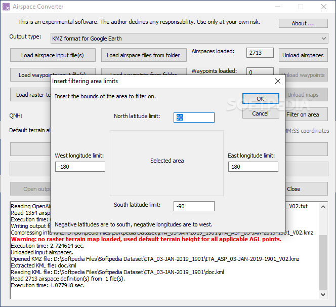
Cropping Your Data
If you're looking to focus on specific areas within your dataset, there's an area filter available! Just enter the coordinates in the filtering wizard and crop out what you don't need.
Connect Data with Terrain Visuals
If you're into linking airspace data with terrain visuals better, this software has conversion and pre-processing features just for you! It allows adding your own airspace information, filtering its extent, and formatting it into whatever output format suits your needs best.
User Reviews for Airspace Converter 15
-
for Airspace Converter
Airspace Converter simplifies converting aeronautical data into user-friendly formats for Google Earth. It offers error notifications and area filtering.
-
for Airspace Converter
Airspace Converter offers efficient airspace conversion; however, the user interface could benefit from enhancements.
-
for Airspace Converter
Airspace Converter is a powerful, easy-to-use tool for converting aviation-oriented documents and data formats.
-
for Airspace Converter
Airspace Converter is a useful, intuitive tool for aviation enthusiasts, though it could use some minor improvements.
-
for Airspace Converter
Airspace Converter is a highly efficient app, although it lacks in-depth tutorials for novice users.
-
for Airspace Converter
Airspace Converter is a revolutionary tool for airspace data transformation. Simplistic UI, seamless navigation, and efficient results.
-
for Airspace Converter
Airspace Converter offers a top-notch experience in converting aeronautical data with impressive accuracy and speed.