
Description
GE Path
GE Path is a cool little CAD tool made just for creating paths and adding descriptions to placemarks you save in Google Earth. It can read KML files, link your placemarks, and even calculate distances between them. Pretty neat, right?
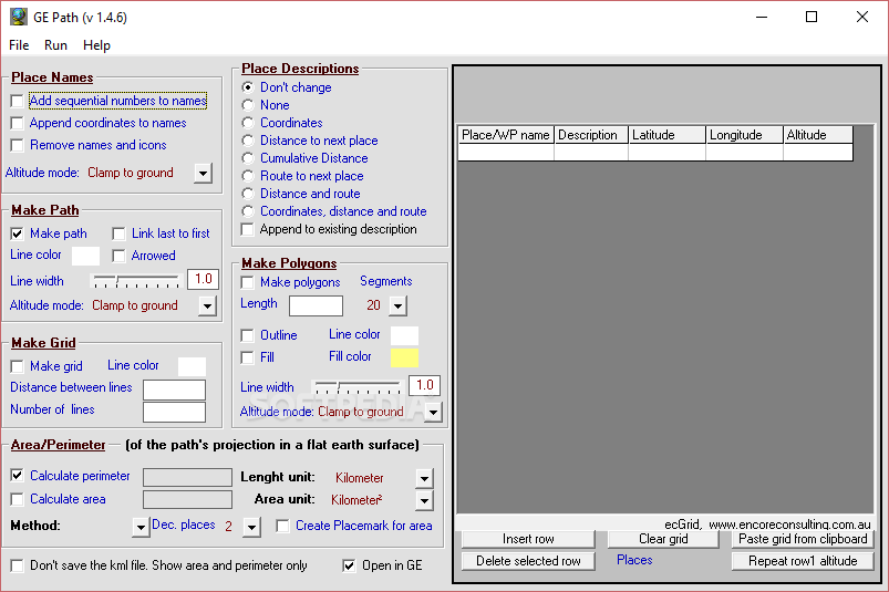
Visual Layout
Now, I’ll be honest—the first look at GE Path might not wow you. The layout feels a bit cramped and overwhelming because it puts all the settings into one panel. But don't let that scare you off; once you get used to it, it's not so bad!
User Support
If you need help figuring things out, there’s a handy help manual included. It gives you all the info about how to set everything up.
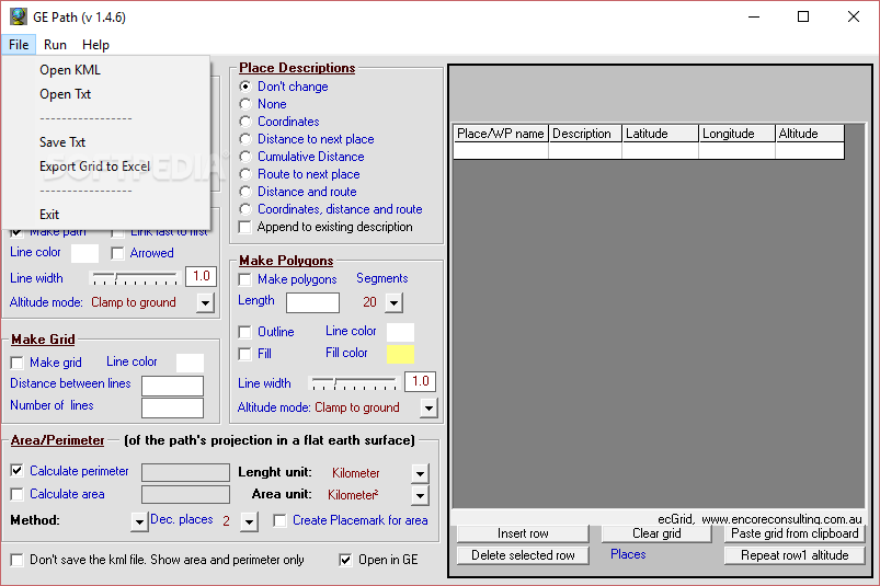
Data Import & Export
With GE Path, you can import data from KML files or even plain text files. You can also save your work as plain text or export it to an XLS file. Plus, it lets you copy data from Excel or Word directly into its built-in table.
Main Features Overview
The main window shows all your stored info nicely—like place names, descriptions, latitude, longitude, and altitude. Just a heads-up: make sure your placemark files only have placemarks and no other stuff like paths or overlays.
Name Management
You have the option to add sequential numbers and coordinates to place names, remove names and icons if needed, and choose the altitude mode for each location.
Description Options
You can keep descriptions as they are or switch things up by adding coordinates or distances to the next spot on your path. You can even choose to show routes between places!
Path Generation Features
When you're ready to create your path, GE Path lets you change line color and width and select the altitude mode too! You can link back around from the last point to the first one if that suits your needs.
Additional Drawing Tools
If you're feeling creative, draw regular polygons around each placemark! You can also calculate the path's length based on how you've arranged them.
A Handy Tool with Some Learning Curve
GE Path has some great features packed in there! However, be prepared: its interface isn't super intuitive at first. So if you're new to this type of software, it might take some time getting everything set up just right.
User Reviews for GE Path 8
-
for GE Path
GE Path provides extensive tools for path creation and editing in Google Earth. However, the crowded interface may be overwhelming for new users.
-
for GE Path
GE Path delivers decent geotagging functionality but lacks intuitiveness.
-
for GE Path
GE Path is a fantastic tool for managing KML files and creating paths in Google Earth. Highly recommend!
-
for GE Path
I love how GE Path simplifies the process of adding placemarks and calculating distances. Five stars!
-
for GE Path
This app has all the features I need for my mapping projects. Easy to use once you get the hang of it!
-
for GE Path
GE Path is incredibly useful for planning routes. The ability to customize paths is a game changer!
-
for GE Path
Great app! It took a bit to learn, but now I can efficiently create paths and manage my data.