
Description
Geosoft Plug-in for ArcGIS - Download Specialized GIS Data Tool
Looking for a powerful solution to enhance your GIS capabilities? The Geosoft Plug-in for ArcGIS provides seamless integration between Geosoft's specialized geoscience data formats and ESRI's industry-standard ArcGIS Desktop environment. This essential extension enables geoscientists, geophysicists, and GIS professionals to work with sophisticated geophysical and geological data directly within their familiar ArcGIS workflow.
Download the Geosoft Plug-in for ArcGIS to unlock the full potential of your geospatial data. This specialized tool bridges the gap between geoscience data formats and traditional GIS operations, saving valuable time and enhancing productivity.
Key Features of the Geosoft Plug-in Extension
The Geosoft Plug-in transforms ArcGIS Desktop into a more versatile geoscience platform by enabling direct access to Geosoft grid files without format conversion. This seamless integration eliminates data transfer bottlenecks and ensures data integrity throughout your projects.
When you download and install this extension, you'll immediately benefit from expanded data access capabilities. The plug-in connects your ArcGIS environment to Geosoft's proprietary file formats, providing a streamlined workflow for geoscience professionals working across multiple data environments.
Advanced Data Access Protocol Integration
One of the most valuable aspects of the Geosoft Plug-in is its ability to retrieve data through DAP (Data Access Protocol). This functionality enables on-demand access to remote datasets, facilitating collaboration across teams and organizations regardless of physical location. The plugin handles the technical complexities of data retrieval, allowing you to focus on analysis and interpretation.
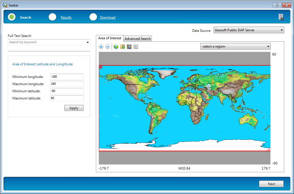
Simplified Search with the Seeker Tool
The integrated Seeker tool revolutionizes how you find and access geoscience data. By streamlining the search process, this intelligent feature significantly reduces the time spent locating specific datasets. The intuitive interface allows you to quickly define search parameters and filter results based on your project requirements.
Data retrieval operations that once required multiple steps are now accomplished with just a few clicks. Download the Geosoft Plug-in to experience this enhanced workflow efficiency and spend more time analyzing data rather than searching for it.
Technical Specifications
- Compatibility: ArcGIS Desktop 10.x and higher
- Supported file formats: Geosoft Grid (.grd), Geosoft Database (.gdb), Geosoft Map (.map)
- Data access: Local files, network resources, DAP servers
- Installation method: Standard installer with ArcGIS integration
- License type: Single-user and network licenses available
- System requirements: Matches ArcGIS Desktop requirements
Benefits for GIS Professionals
By downloading the Geosoft Plug-in extension, GIS professionals gain immediate access to specialized geoscience data formats without leaving their familiar ArcGIS environment. This integration eliminates the need for format conversions that can introduce errors or data loss, ensuring the highest data quality for critical projects.
Enhanced Workflow Efficiency
The plug-in streamlines workflows by removing barriers between different data environments. Users can seamlessly incorporate Geosoft's specialized geoscience data alongside traditional GIS layers, creating more comprehensive and informative maps and analyses.
With the ability to directly access and manipulate Geosoft grid files, professionals can maintain data in its native format while leveraging ArcGIS Desktop's powerful spatial analysis tools. This hybrid approach combines the strengths of both platforms for optimal results.
Expanded Data Accessibility
The Geosoft extension expands your data horizon by providing access to proprietary geoscience formats that would otherwise require specialized software. This capability is particularly valuable for organizations working across multiple disciplines or collaborating with partners who use different software environments.
Data sharing becomes significantly more straightforward when team members can access specialized formats through commonly available GIS software. The plug-in serves as a bridge between specialized geoscience data and mainstream GIS applications.
Ideal Applications
This powerful extension is particularly valuable for professionals working in:
- Mineral exploration and mining
- Oil and gas exploration
- Environmental assessment
- Geological surveys
- Academic research in geosciences
- Government agencies managing natural resources
Download the Geosoft Plug-in for ArcGIS today to transform how you work with specialized geoscience data. Whether you're a geophysicist needing to share results with GIS specialists or a GIS professional tasked with incorporating geophysical data into your projects, this essential tool provides the seamless integration you need.

Experience the convenience of unified data access across platforms. The Geosoft Plug-in extension eliminates technical barriers and creates a more integrated workflow between specialized geoscience data and mainstream GIS operations.
Ready to enhance your ArcGIS capabilities? Download the Geosoft Plug-in now and discover how this specialized tool can transform your geospatial workflow.
```
User Reviews for Geosoft Plug-in for ArcGIS 8
-
for Geosoft Plug-in for ArcGIS
Geosoft Plug-in for ArcGIS facilitates viewing Geosoft grid files in ArcGIS Desktop. Seeker tool simplifies data search and retrieval.
-
for Geosoft Plug-in for ArcGIS
The Geosoft Plug-in for ArcGIS makes GIS integration seamless and efficient.
-
for Geosoft Plug-in for ArcGIS
Geosoft Plug-in for ArcGIS is a game changer! It makes viewing grid files seamless and efficient.
-
for Geosoft Plug-in for ArcGIS
Absolutely love this app! The Seeker tool simplifies data searches and saves me so much time!
-
for Geosoft Plug-in for ArcGIS
Fantastic tool for accessing Geosoft formats in ArcGIS! Highly recommend it to all GIS professionals.
-
for Geosoft Plug-in for ArcGIS
The Geosoft Plug-in is essential for my work. Fast, reliable, and user-friendly. Five stars!
-
for Geosoft Plug-in for ArcGIS
This app has transformed how I work with Geosoft files in ArcGIS. Easy to use and very effective!