
Description
GIS.XL Download: Transform Excel Values into Geospatial Map Data
When it comes to handling spatial data with precision and efficiency, GIS.XL stands out as an exceptional Microsoft Excel add-in that transforms the way topography experts work with geospatial information. This powerful utility bridges the gap between spreadsheet data and map visualization, allowing you to seamlessly convert Excel values into interactive map representations. If you're looking to download GIS.XL for your spatial data analysis needs, you'll find this tool significantly streamlines complex geospatial workflows.

Essential Integration for Geospatial Analysis in Excel
GIS.XL provides an intuitive solution for professionals who regularly work with geographic information systems but prefer the familiar Excel environment. Before you download GIS.XL, note that this specialized add-in requires both Microsoft Excel and .NET Framework to function properly on your system. Once these prerequisites are met, the installation process is straightforward, following simple on-screen instructions without demanding any complex configuration steps.
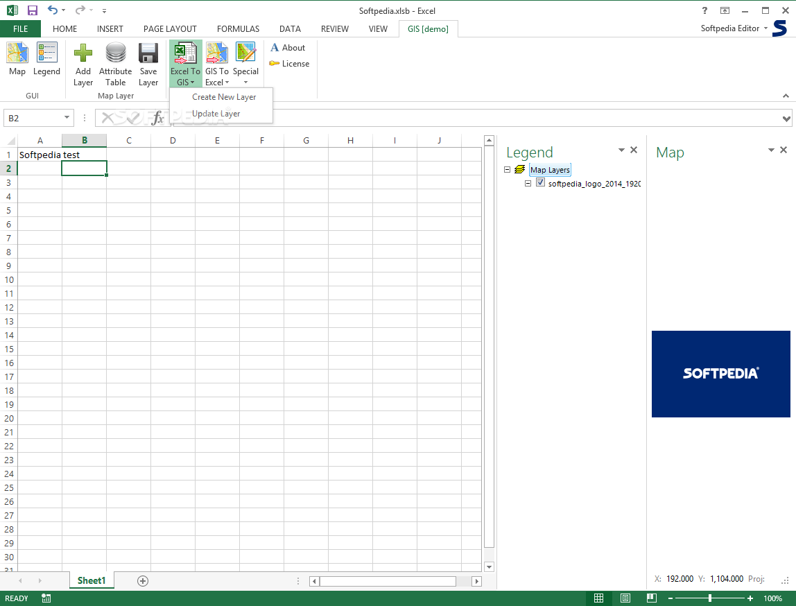
After installation, accessing the full range of GIS.XL's geospatial functions becomes remarkably simple through the dedicated Excel ribbon button. The ribbon interface organizes all mapping and conversion tools logically, enabling quick access to the precise spatial data functions you need. For topography experts and GIS professionals, this integration creates a seamless workflow between spreadsheet calculations and map visualizations.
Powerful Spatial Data Conversion Capabilities
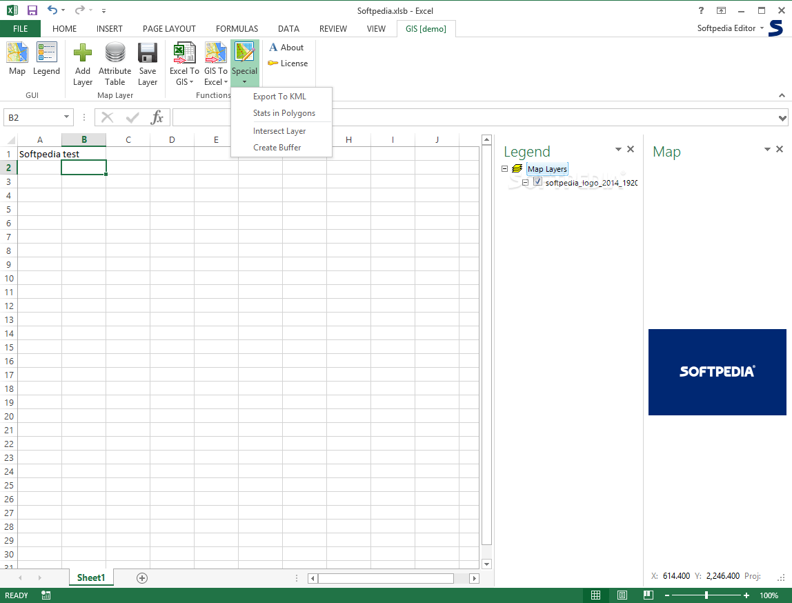
The core functionality of GIS.XL centers around its ability to transform Excel spreadsheet values into comprehensive map data. When you download GIS.XL, you gain access to specialized features that let you visualize numerical data geographically without leaving your Excel workspace. The software supports multi-layered maps, allowing you to import existing map documents from your computer with a simple click of the Map button.
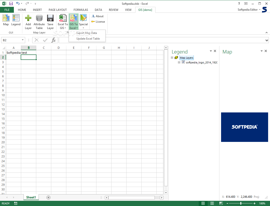
Additionally, GIS.XL enables the creation of detailed map legends that enhance data organization and interpretation. These legends can be customized to represent different data categories, making your spatial information more accessible and meaningful. The bidirectional conversion capabilities mean you can not only turn Excel tables into spatial map data but also import map data back into Excel spreadsheets when needed.
Key Features of GIS.XL
- Seamless Excel integration through dedicated ribbon interface
- Conversion of spreadsheet values to interactive map data
- Support for multi-layered map visualization
- Custom legend creation for enhanced data organization
- Bidirectional data conversion between Excel and maps
- Streamlined workflows for topography professionals

System Requirements and Installation
Before you download GIS.XL for your geospatial analysis work, ensure your system meets these technical specifications:
- Microsoft Excel (compatible with recent versions)
- .NET Framework (latest version recommended)
- Windows operating system
- Minimum 4GB RAM for optimal performance
- Sufficient disk space for map data storage
The installation process requires minimal user intervention, making it accessible even for those with limited technical expertise. However, while the installation is straightforward, effectively utilizing GIS.XL does require advanced computer skills and a solid understanding of geospatial analysis concepts. This tool is primarily designed for professionals in fields such as geography, urban planning, environmental science, and other disciplines that regularly work with spatial data.
User Interface and Accessibility
GIS.XL features an intuitive interface that integrates seamlessly with Excel's native environment. When you download GIS.XL and launch it within Excel, you'll find the geospatial functions logically organized in the ribbon menu, making them readily accessible during your workflow. This thoughtful organization ensures that even complex geospatial operations can be executed with minimal navigation.
The software prioritizes user experience without sacrificing functionality, striking an ideal balance between comprehensive features and operational simplicity. For professionals who regularly work with both spreadsheets and spatial data, this integration eliminates the need to constantly switch between different software platforms.
Practical Applications for Geospatial Professionals
After you download GIS.XL, you'll discover numerous practical applications that can enhance your geospatial analysis workflow. Urban planners can visualize population density data directly from census spreadsheets. Environmental scientists can map pollution measurements across geographic regions. Real estate analysts can transform property value data into insightful market maps.
The ability to quickly toggle between tabular data and spatial visualization makes GIS.XL an invaluable tool for presentations, reports, and data-driven decision making. The software essentially eliminates the traditional barrier between spreadsheet analysis and geographic information systems, creating a unified workspace for comprehensive spatial data management.
In conclusion, GIS.XL offers a specialized solution for professionals who need to bridge Excel's calculation capabilities with geospatial visualization. When you download GIS.XL, you're equipping yourself with a powerful add-in that simplifies complex spatial data workflows, enables bidirectional conversion between spreadsheets and maps, and ultimately enhances your productivity as a geospatial analyst or topography expert.
```
User Reviews for GIS.XL 8
-
for GIS.XL
GIS.XL streamlines spatial data processing efficiently within Microsoft Excel, catering to advanced users. Easily deployable with no complex setup.
-
for GIS.XL
GIS.XL gives robust functionalities for seamless Geographic Information System experience.
-
for GIS.XL
GIS.XL has transformed how I work with spatial data! The integration with Excel is seamless and efficient.
-
for GIS.XL
This app is a game-changer for geospatial analysis. It's user-friendly and helps visualize data effortlessly!
-
for GIS.XL
Absolutely love GIS.XL! It simplifies complex tasks and the interface is well-organized. Highly recommend!
-
for GIS.XL
GIS.XL makes processing spatial data a breeze. The tools are intuitive, making my workflow much smoother.
-
for GIS.XL
What an incredible tool! GIS.XL allows me to turn Excel values into maps easily. A must-have for experts!