
Description
NOAA's Vertical Datum Transformation
Have you ever thought about how important maps are for things like geography, navigation, and even orienteering? Well, if you're into that stuff, then NOAA's Vertical Datum Transformation is something you should definitely check out! This program lets you improve or change horizontal and vertical DATUM info into a common system, which is super handy.
Download Size and Internet Connection
Now, one thing to keep in mind is that NOAA's Vertical Datum Transformation is quite a hefty program. If your internet connection isn't super fast, downloading the whole file might be a bit of a hassle. While it comes packed with detailed and up-to-date map information—which is crucial for what it does—it can also take up a lot of space on your device.
Limitations on Geographic Support
The software currently supports only the USA, which can be a bummer if you're looking for global coverage. If they could add separate content patches for other countries or different downloads for various regions within the USA, that would really help users manage the size of the application better.
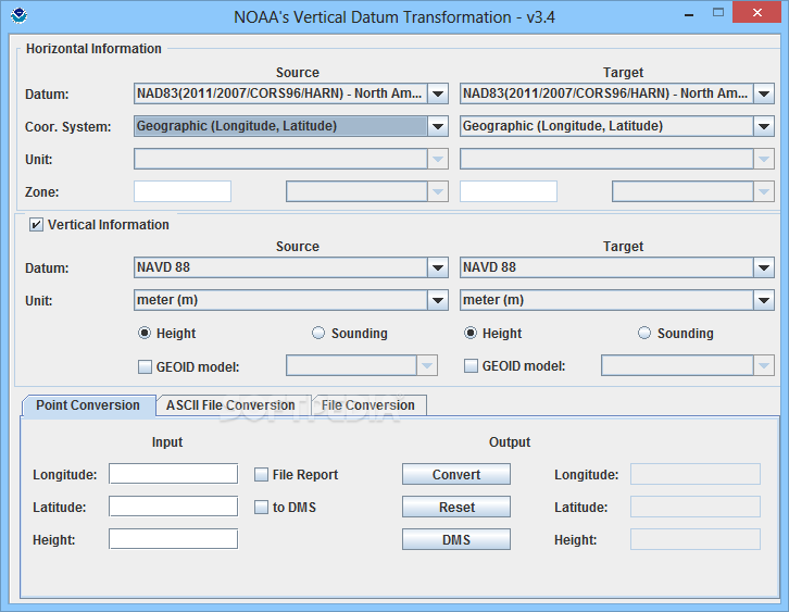
User-Friendly Interface
If you're worried about DATUMs being complicated, don't be! NOAA's Vertical Datum Transformation makes it pretty straightforward. It has just one main window with three tabs for geographical point conversion plus two tabs for file conversion: ASCII and ASPRS.
Input Requirements
You only need to enter the longitude and latitude of your specific point along with its height in meters. However, it's worth noting that using meters feels a bit odd since most places in the USA use Imperial measurements. A choice between feet and meters would make more sense given this limitation.
Final Thoughts on NOAA's Vertical Datum Transformation
Overall, NOAA's Vertical Datum Transformation is an awesome tool for anyone interested in maps and geography. Just remember that the large file size can be a downside. If they could break it down into smaller downloads based on regions, it would make life easier for those who can't handle all that data at once. Ready to give it a try? You can download it here!
User Reviews for NOAA's Vertical Datum Transformation 7
-
for NOAA's Vertical Datum Transformation
NOAA's Vertical Datum Transformation is a valuable tool for map enthusiasts. The detailed map info and easy-to-use interface are commendable.
-
for NOAA's Vertical Datum Transformation
Absolutely love NOAA's Vertical Datum Transformation! It’s user-friendly and helps me with accurate map navigation.
-
for NOAA's Vertical Datum Transformation
This app is fantastic for anyone into geography. The detailed maps have really improved my navigation skills!
-
for NOAA's Vertical Datum Transformation
NOAA's Vertical Datum Transformation is a game-changer! It simplifies complex DATUMs and makes mapping fun!
-
for NOAA's Vertical Datum Transformation
I found this app super helpful. The conversion process is straightforward, making it great for map enthusiasts!
-
for NOAA's Vertical Datum Transformation
This tool is essential for anyone interested in geography. The detailed information provided is top-notch!
-
for NOAA's Vertical Datum Transformation
Highly recommend NOAA's app! It's clear, easy to use, and offers amazing support for mapping accuracy.