

Description
TopoLT
TopoLT is an awesome software that helps you create topographical or cadastral plans in a digital format using AutoCAD or other CAD platforms. It’s super handy for anyone working with land measurements and maps!
Easy-to-Use Interface
This program has three different panes, each designed to make your life easier. You can draw coordinates directly from your total station, send coordinates back to it, and even view 3D models created through calculations. The layout is clean and straightforward, so you won’t waste time figuring things out.
Coordinate Management
With TopoLT, drawing points from specified coordinates is a breeze! You can save these coordinates to a file for future projects. Plus, it lets you import data from various file formats like COO, CSV, XYZ, REC, SDR, GSI, GDM, RAW, and others. So no matter what files you have on hand, TopoLT has got you covered.
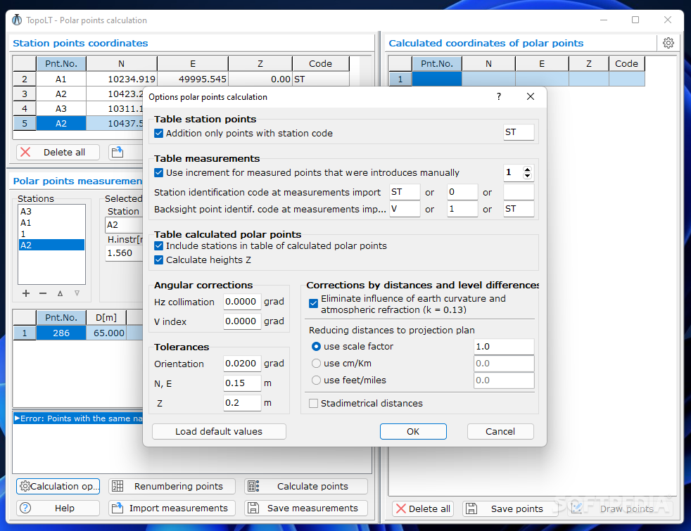
Add Stations and Calculate Points
You can add multiple stations to your list and calculate point coordinates using two methods: polar and direct intersections. Need to find specific points? There’s a search feature just for that!
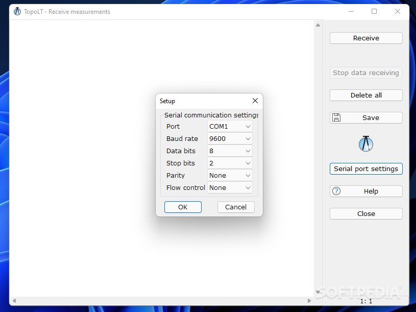
Receiving Measured Data
A cool feature of TopoLT allows you to receive measured data through serial ports (like COM1 or COM2) from various instruments such as total stations or field books. All you need to do is connect the instrument to your PC and set up the serial communication parameters. You can also save this information into a plain text file for easy access later.
Create Stunning 3D Models
Last but not least, TopoLT enables you to view models in a 3D environment where you can rotate them at different angles. You can save generated images as JPG or BMP files and tweak settings like background color, size, light intensity, and texture quality. Want to record your work? You can even save the 3D rendering mode as an AVI file! Plus, it supports uploading 3DS files and switching to full screen mode for a better look.
A Professional Tool for Your Projects
Overall, TopoLT comes packed with tons of useful features that help users develop 3D terrain models or tackle other projects in a professional way! If you're looking for reliable software that makes topographical planning easier than ever before, check it out here!
User Reviews for TopoLT 11
-
for TopoLT
TopoLT offers a clean interface for creating topographical plans, drawing coordinates, and importing data from various file formats with ease.
-
for TopoLT
The TopoLT app provides reliable and precise drafting and topographical services. A bit complex initially but worth the learn.
-
for TopoLT
TopoLT offers impressive features for 3D modeling and topographical details, though a steep learning curve exists.
-
for TopoLT
TopoLT is a useful surveying and design app. It is feature-rich and intuitive, although the UI could be improved.
-
for TopoLT
TopoLT is an efficient and reliable tool for professionals; however, it comes with a steep learning curve.
-
for TopoLT
TopoLT is an incredible app for creating topographical plans! The interface is user-friendly and efficient.
-
for TopoLT
I absolutely love TopoLT! It simplifies my workflow in AutoCAD and the 3D modeling features are fantastic!