
Description
Wxtrack - Download the Ultimate Satellite Tracking and Weather Image Prediction Tool
Are you fascinated by weather satellites and looking to download a comprehensive tracking solution? Wxtrack download offers an exceptional tool for meteorology enthusiasts, researchers, and educational institutions who want to monitor and predict the paths of weather satellites while accessing the images they produce. This powerful software enables users to visualize satellite trajectories, compare predicted paths with actual ground scans, and manage multiple tracking systems through one intuitive interface.
Comprehensive Satellite Tracking Features
When you download Wxtrack, you gain access to a sophisticated yet user-friendly application designed specifically for satellite tracking enthusiasts. Following a quick and straightforward installation process, the program welcomes you with a clean, minimalist interface organized into functional tabs for efficient navigation and operation.
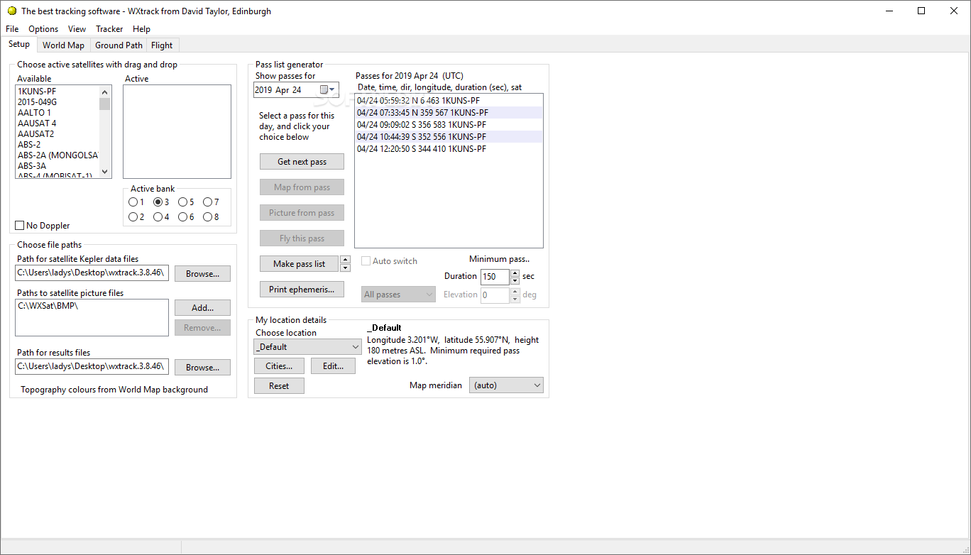
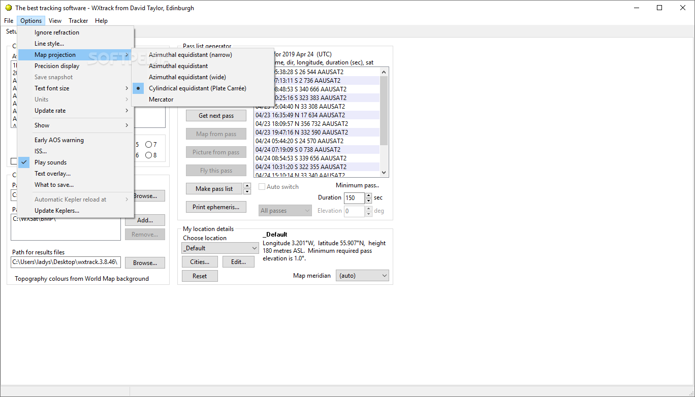
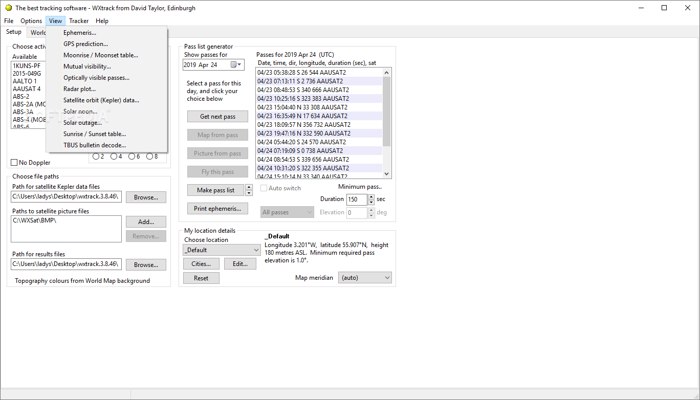
The Setup tab serves as your control center, allowing you to select active satellites from an extensive database and instantly view critical path information. Track essential details including dates, times, longitudes, and latitudes of satellite paths for the current day, ensuring you never miss an important pass.

Interactive World Map Visualization
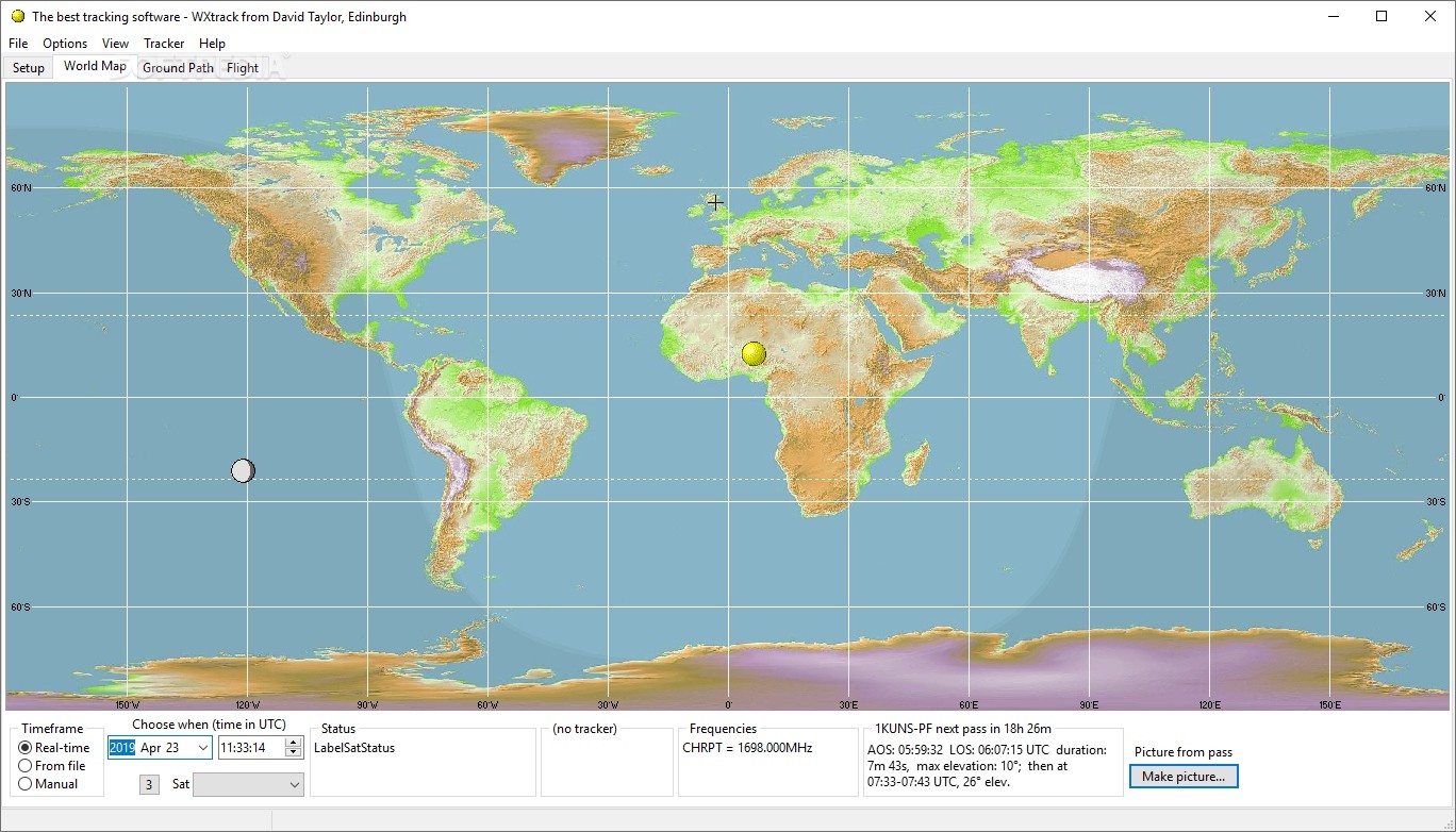
The World Map tab transforms complex satellite data into visually accessible information. After you download Wxtrack, you'll be able to preview current satellite routes in real-time and access detailed forecasts about future positions at pre-defined times. This visualization capability makes Wxtrack an invaluable tool for educational demonstrations, research projects, and hobbyist exploration of weather satellite systems.
Satellite tracking enthusiasts can also discover potential trackers and AAUSATS2 frequencies when available, adding another layer of utility to this versatile application. The satellite tracking software provides comprehensive data visualization that helps users better understand orbital mechanics and satellite operations.
Multi-System Compatibility
Wxtrack stands out among satellite tracking tools by offering exceptional compatibility with numerous tracking systems. The application supports controllers based on:
- EA4TX's ARSWIN
- SeaTel systems
- EasyComm protocols
- IF-100 controllers
- FodTrack standard interfaces
- Many other popular tracking systems
This wide-ranging compatibility ensures that when you download Wxtrack, you'll likely find support for your existing hardware setup, making integration seamless and efficient.
Customizable Tracking Parameters
The weather satellite tracker offers extensive customization options for precise control over your tracking activities:
- Configurable tracking start times
- Antenna offset adjustments
- Parking at pass end functionality
- Flip-mode options for advanced tracking scenarios
- Custom alert settings for upcoming satellite passes

Advanced Image Processing Capabilities
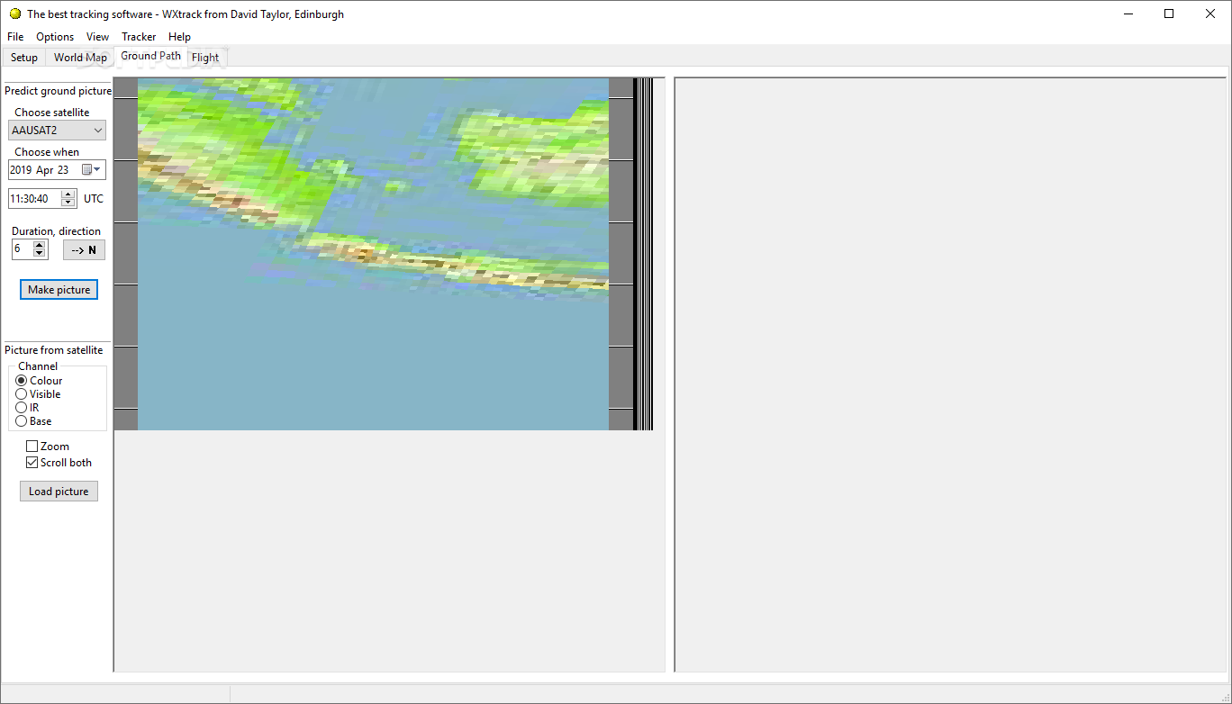
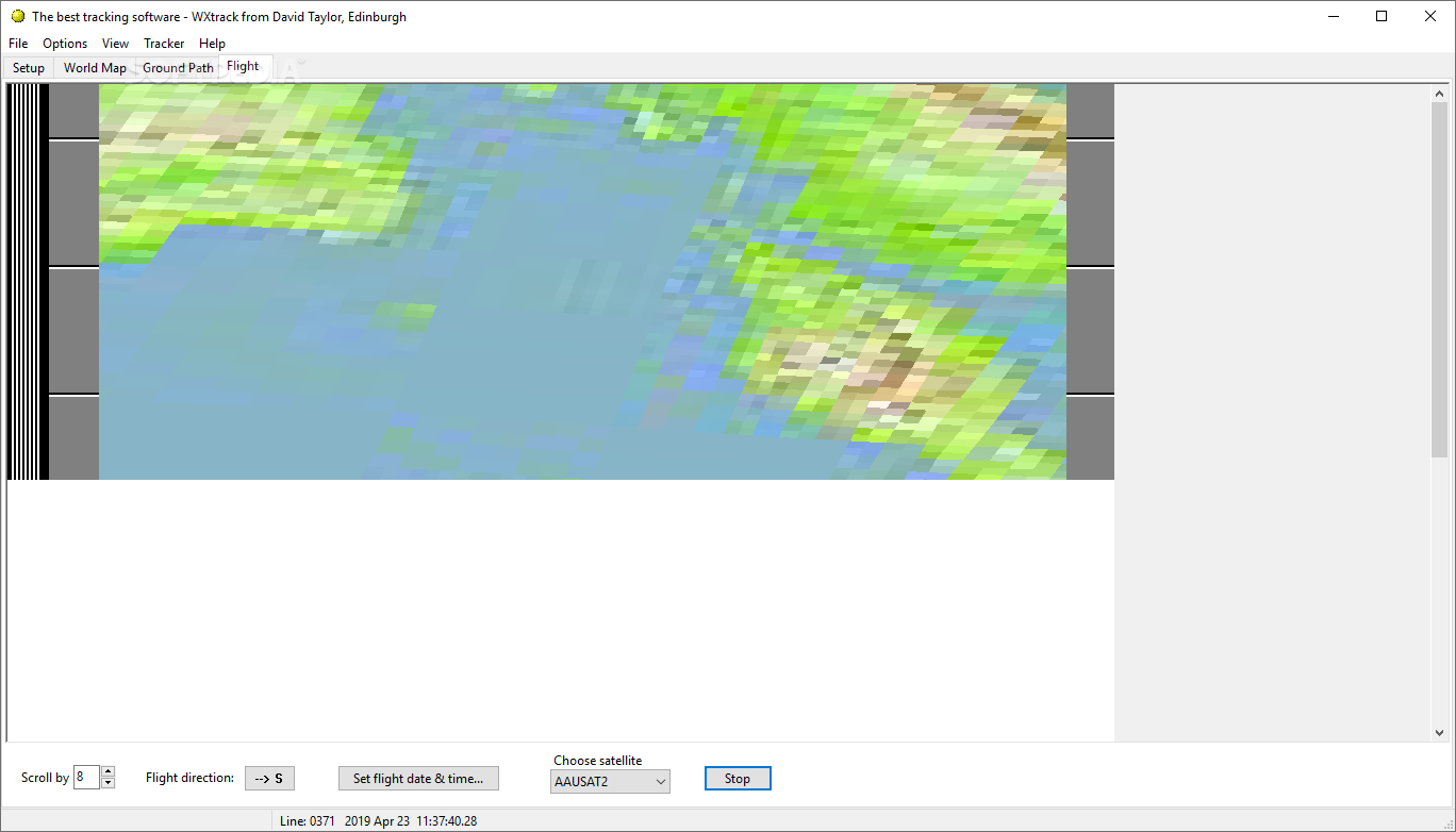
Wxtrack goes beyond mere tracking to offer sophisticated image handling features. The program can be configured to read satellite images from any folder you designate and automatically compare them with ground track predictions. This functionality creates a powerful analytical tool for meteorologists, researchers, and weather enthusiasts alike.
The satellite tracker incorporates minute markers on predicted images that match those on NOAA APT transmissions, facilitating visual correlations and enhancing the accuracy of your analyses. This attention to detail makes Wxtrack the preferred weather satellite software download for professionals and serious enthusiasts who demand precision.
Technical Specifications
- Compatible OS: Windows 7/8/10/11
- Disk Space Required: 50MB
- Memory Usage: Minimal (runs efficiently on most systems)
- Internet Connection: Required for satellite data updates
- Supported Satellites: NOAA series, METEOR, RESURS, and many others
- Data Format: Compatible with standard meteorological formats
Known Limitations
The developer transparently acknowledges certain limitations within the application:
- Most dates and times are displayed in UTC format only
- Some parameters for RESURS and METEOR satellites are based on best estimates due to limited available data
- RESURS scanning may not always align symmetrically, with southbound images sometimes centered slightly further west than predicted paths
Despite these minor limitations, Wxtrack remains a trusted and widely used solution among universities, research institutions, and satellite enthusiasts worldwide. Its combination of accuracy, ease of use, and comprehensive features makes it a standout choice when searching for a weather satellite tracking software download.
Educational and Research Applications
For educational institutions, Wxtrack provides an exceptional platform for teaching orbital mechanics, satellite operations, and meteorological principles. The visual nature of the software helps students grasp complex concepts while engaging with real-world satellite data. Researchers benefit from the precise tracking capabilities and image correlation features that support various atmospheric and weather pattern studies.
Ready to explore the fascinating world of weather satellites? Download Wxtrack today and join the global community of professionals, educators, and enthusiasts who rely on this powerful tracking tool for their satellite monitoring needs.
```
User Reviews for WXtrack 7
-
for WXtrack
WXtrack provides accurate tracking and prediction of weather satellites' paths. The interface is minimalistic, making it easy to use.
-
for WXtrack
Wxtrack is an incredible app for tracking weather satellites! The interface is clean and user-friendly.
-
for WXtrack
I love Wxtrack! It provides accurate satellite paths and amazing images, making my research so much easier.
-
for WXtrack
Fantastic app! Wxtrack helps me predict satellite movements effortlessly. Highly recommend it to enthusiasts!
-
for WXtrack
Wxtrack is a game-changer for anyone interested in satellites. The setup was quick, and the features are impressive!
-
for WXtrack
I’m amazed by how well Wxtrack works! The minimalistic design and powerful functions make tracking fun.
-
for WXtrack
Awesome app! Wxtrack delivers reliable predictions and beautiful satellite images. Perfect for my studies!