
Description
Canada Topo Maps - Free Outdoor Navigation App
Explore the wilderness of Canada with the Canada Topo Maps app, offering easy access to the best maps and aerial imagery for your outdoor adventures.
Features:
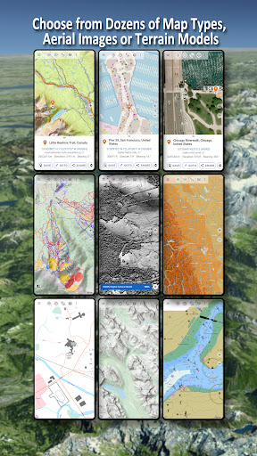
- Choose from 30+ map layers including topos, aerials, and sea charts
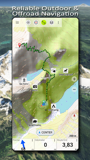
- Turn your Android device into a GPS for offline backcountry trips
- Utilize Canada Base Map, Toporama, or OpenStreetMap for the most recent topo maps
- Add maps from various sources such as GeoPDF, GeoTiff, and WMS
- Access base map layers for Canada and worldwide maps
Basemap Layers:
- Topomaps Canada with seamless coverage at various scales
- Canada Basemap CBMT with detailed information
- Toporama Maps Canada in English and French
- CanTopo for new Canada Topos
- Various other map layers for specific regions in Canada
Additional Features:
- Download map data for offline usage
- Measure paths and areas
- Create and edit waypoints and routes
- Track recording with speed and elevation profile
- Search for places, POIs, and streets
- Share waypoints, tracks, and routes via email or messaging apps
Enhance your outdoor activities such as hiking, biking, camping, skiing, and more with the Canada Topo Maps app. Download now for free and start exploring!
User Reviews for Canada Topo Maps 1
-
for Canada Topo Maps
Canada Topo Maps is an essential outdoor companion. Easy to use, versatile map layers and offline GPS make it perfect for adventurers.