

Description
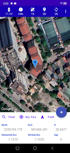
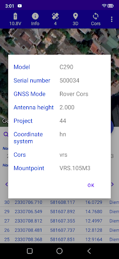
1. Connect (via Bluetooth) and Display GNSS receiver data)
2. Coordinates management (WGS84 and VN2000)
3. NTRIP Client/Source
4. Position finding/ Route finding
5. KML file display
6. Store points, along with projects management
7. Configuration for receivers
8. Testing: Tilt compensation
For more info, visit:
https://tnrtk.wordpress.com/
User Reviews for GNSS Survey 1
-
for GNSS Survey
GNSS Survey is a powerful tool for GNSS data analysis and management. Useful features like NTRIP Client and route finding.