
Description
GPSNavX
GPSNavX is a cool Mac app that lets you plan boat routes right from your computer. If you've got a GPS device linked up, GPSNavX will show your location on the chart live, keeping track of where you're headed!
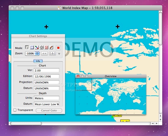
Using Marine Charts
This app comes with a basic world map to get you started, but to really make the most of it, you'll want to import your own marine charts. The good news? You can export your plotted routes and charts as KML files, which work great with Google Earth!
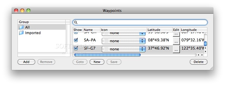
Create Waypoints Easily
With GPSNavX, setting waypoints for places you want to check out is super simple. You can add any info that might help when planning your journey. Plus, it shows you how far apart each waypoint is and the total distance for the entire trip!
Real-Time Data at Your Fingertips
This app doesn’t just show where you are; it gives real-time updates on things like speed over ground and course over ground. You can see details like bearing at waypoint, distance at waypoint, and even how long it'll take to reach your destination.
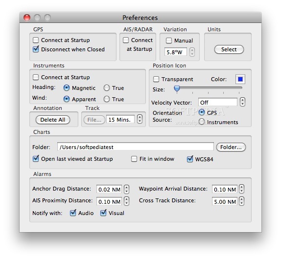
Track All Important Info
GPSNavX also shows useful data about heading, speed, wind angle, depth, and more! So when you're ready to hit the water, all the info you need is right there in front of you.
The Perfect Companion for Boating Trips
If you're planning some fun boat trips or just want to keep tabs on your progress while sharing details with friends, GPSNavX is the tool for you! And remember, all that collected data? It can be exported as KML files too!
So why wait? Download GPSNavX today and start planning those awesome boating adventures!
User Reviews for GPSNavX FOR MAC 1
-
for GPSNavX FOR MAC
GPSNavX FOR MAC is a fantastic tool for boat route planning. Real-time updates, waypoint creation, and detailed information display make it a must-have.