
Description
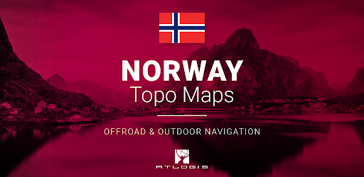
Norway Topo Maps
Looking for the best topographic maps and satellite images for Norway? Look no further than Norway Topo Maps, the ultimate Outdoor/Offline GPS navigation app. Get ready to explore the great outdoors with ease!
Key Features:
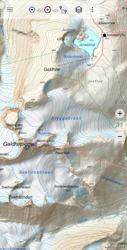
- Access to various base map layers including Topographic Map 1:50.000, Norway Base Map, RNC Nautical Charts, Seefloor Terrain Map, and Historical Maps.
- Overlay map layers for Trekking, Biking, Skiing, and more.
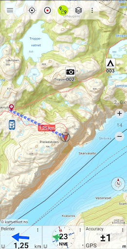
- Create and edit Waypoints, Track Recording, Tripmaster, and GPX/KML/KMZ Export.
- Search for placenames, POIs, and streets with customizable datafields.
- Share Waypoints, Tracks, and Routes via multiple platforms.
- Offline Use with easy bulk-download of map tiles for offline usage.
- Create and edit Routes, Route-Navigation, and import/export GPX/KML/KMZ files.
- Add custom map tile servers and enjoy an ad-free experience.
Additional Information:
- All viewed map tiles are cached for offline use.
- Use this app for activities like hiking, biking, camping, skiing, hunting, and more.
- Import/Export/Share GPS-Waypoints/Tracks/Routes in GPX or Google Earth KML/KMZ format.
- Preload FREE map data for areas without cell service.
Pro Features:
Unlock even more features with In-App Purchases:
- Offline Use without cell coverage and no roaming fees.
- Easy and fast bulk-download of map tiles for offline usage.
- Unlimited Waypoints & Tracks, and the ability to add other Map Tile-Servers.
Don't miss out on the opportunity to enhance your outdoor navigation experience with Norway Topo Maps. Download the app now and start exploring!
User Reviews for Norway Topo Maps 1
-
for Norway Topo Maps
Norway Topo Maps offers comprehensive map layers for outdoor enthusiasts. Pro features ensure offline usability without ads. Ideal for hiking, biking, and more.