

Description
openLISEM
openLISEM is a software that really makes studying soil a bit easier. We all know how the soil changes constantly, right? So, if you want to keep up with those changes, you usually need to run tests pretty often. This can be super tedious and take up a lot of your time. But guess what? There’s a simpler way! You can use specialized software like openLISEM to help estimate those important values.
Getting Started with openLISEM
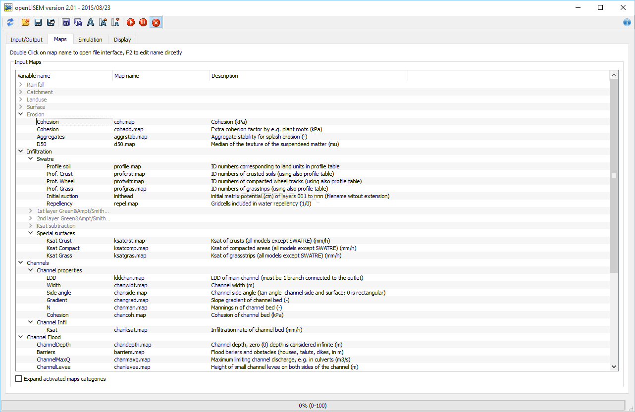
This application works hand-in-hand with PCRaster. It’s essential for creating maps, scripts, and databases. When you first open up openLISEM, you'll notice it has a fancy layout packed with lots of exclusive features. However, it might take some time to get used to if you're not already familiar with geology or computer tech.
User-Friendly Functions
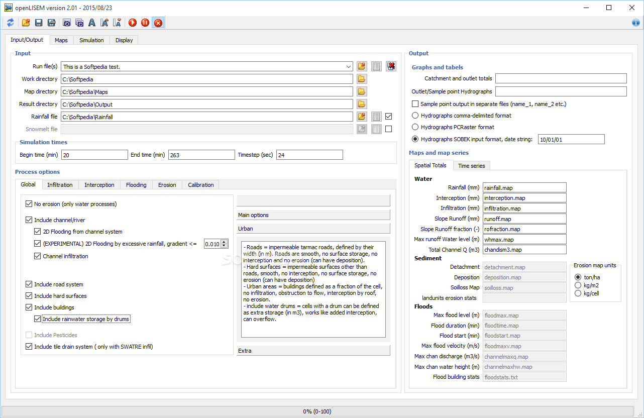
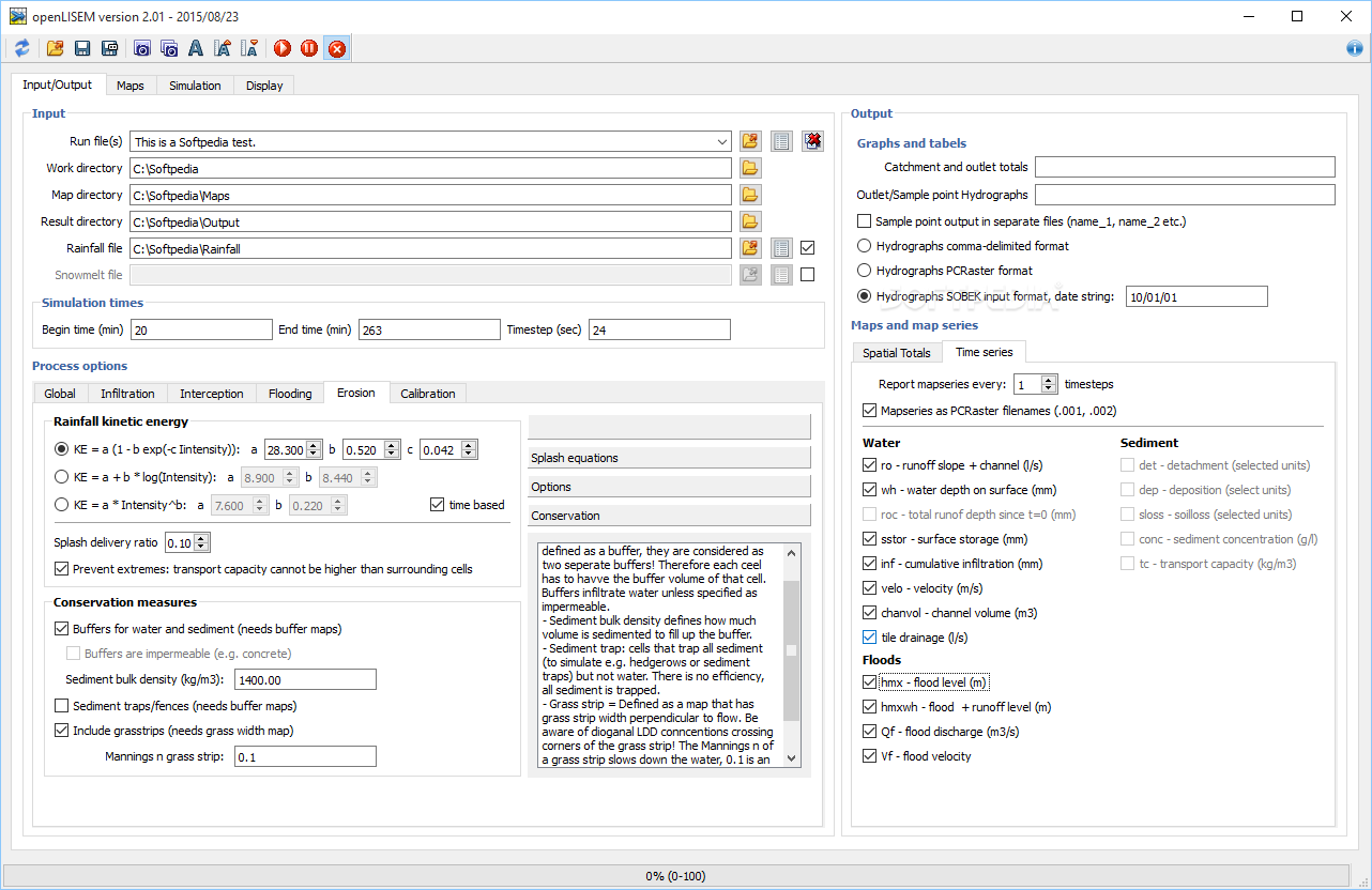
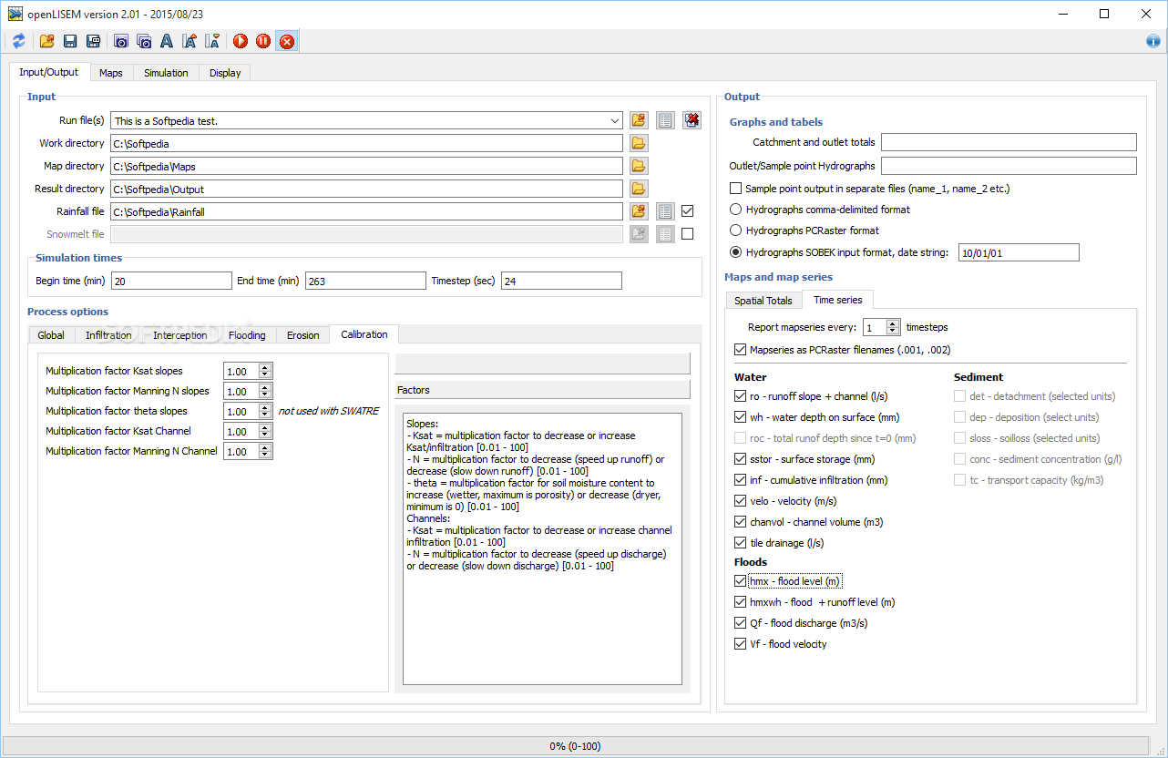
One cool thing about openLISEM is that it doesn’t have a traditional configuration menu like other software. Instead, all its main functions are right there in the main window. They’re organized into tabs, making it easy for you to find what you need without digging around too much.
Diving Into the Details
Even though the parameters are easy to access, they can get pretty technical. If you’re new to this field, don’t be surprised if you find yourself checking the user guide often—it’s got tons of useful info!
Simulations Made Easy
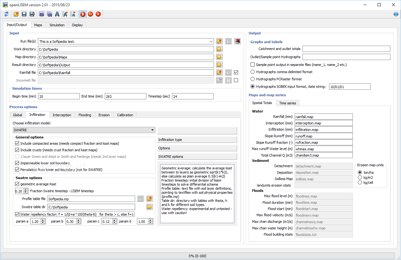
openLISEM gives you tons of scientific tools that let you simulate floods, runoff, and erosion as long as you've got enough data on hand. You can even customize infiltration settings by picking from various models and deciding what elements to include—like compacted areas or crusts.
Customizing Your Environment
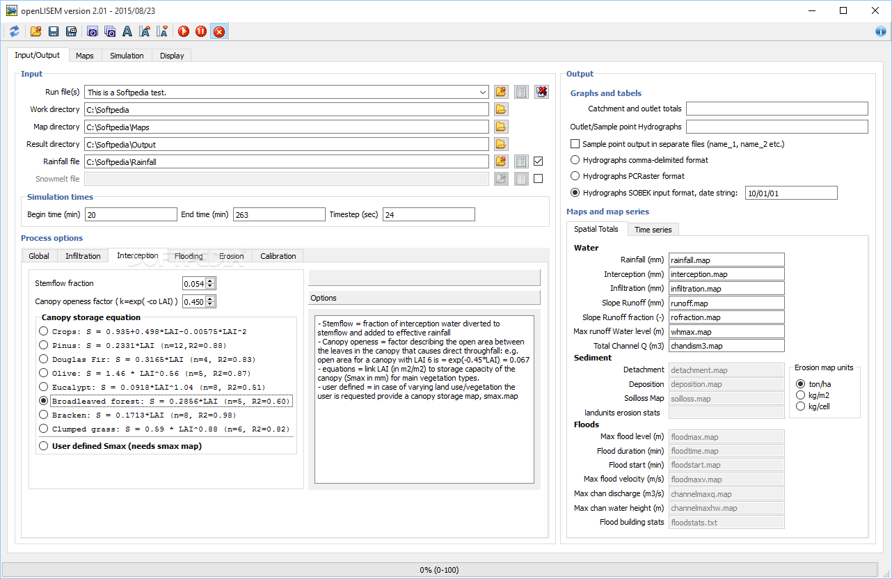
If you're looking at forested areas, you can adjust water interception values by choosing different tree types such as Pinus or Olive trees—or even create your own custom options!
Flood Simulations
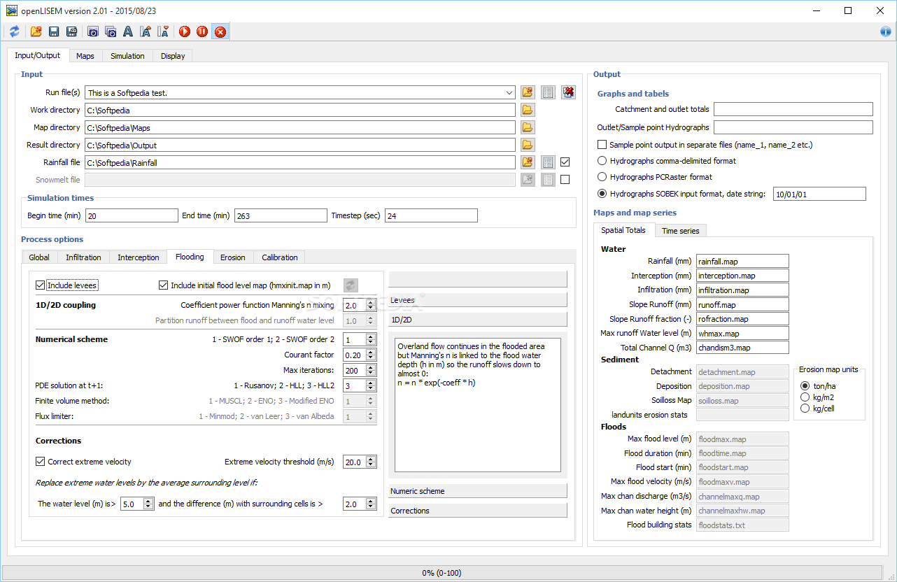
You can also set conditions for flooding by adding levees and including initial flood level maps if they’re available. Plus, there’s room for customizing things like extreme velocity and water levels during these simulations.
Analyzing Your Data
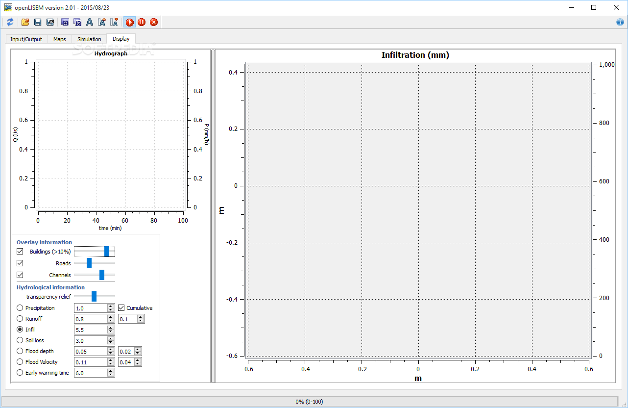
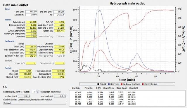
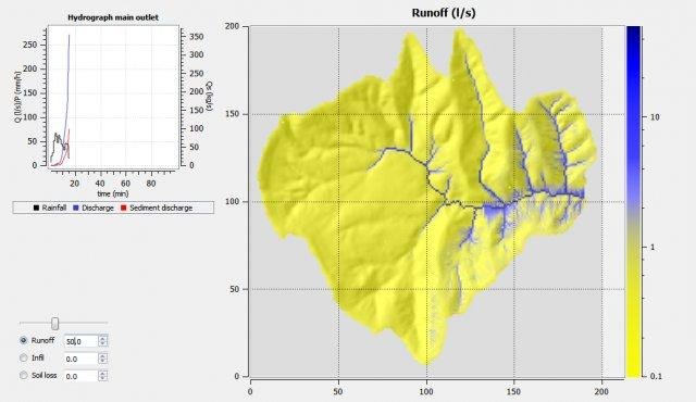
The graphs in openLISEM let you analyze all sorts of details about your processes—things like precipitation levels, runoff rates, flood depth, and even how fast the floodwaters are moving.
Your Reliable Tool for Soil Studies
The simulation section is particularly handy because it shows complex data regarding water flow, sediment movement, catchment outlets, and buffers. So overall, download openLISEM now! It’s an excellent tool if you're looking for a spatial model focused on runoff management and flood simulations with loads of customization options!
User Reviews for openLISEM 7
-
for openLISEM
openLISEM provides a sophisticated solution for soil studies. Its specialized functions may require high geology and computer knowledge.
-
for openLISEM
openLISEM is a game changer for soil studies! Its features are powerful and user-friendly. Highly recommend!
-
for openLISEM
Absolutely love openLISEM! The ability to simulate floods and erosion is invaluable for my research.
-
for openLISEM
This app simplifies complex soil analysis! The detailed graphs and customization options are fantastic!
-
for openLISEM
openLISEM is incredibly useful for environmental studies. Its sophisticated tools save me so much time!
-
for openLISEM
What an amazing tool! openLISEM makes analyzing soil data straightforward with its intuitive interface.
-
for openLISEM
Highly impressed by openLISEM! It offers comprehensive simulations that enhance my geological research.