Description
progeEARTH Land Development Suite
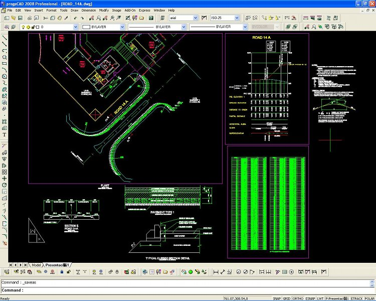
progeEARTH is a fantastic software that brings together Survey, Cogo, DTM, and Road Design tools. This means you can handle land surveys and coordinate geometry without breaking the bank! If you've ever thought about how pricey some land survey software can be, progeEARTH offers a budget-friendly option that works great with AutoCAD DWG files.
Affordable Survey Solutions
This software is perfect for anyone who finds themselves working in the fields of land surveying or civil engineering. It's designed to help you use the commands and menus you're already familiar with from AutoCAD. So, if you're used to certain fonts or hatch patterns, you won't feel lost here!
Great for Professionals
Whether you're a professional land surveyor or a civil engineer, progeEARTH gives you an economical solution without skimping on features. It's also super useful for architects who need to share their data easily with engineers.
Total Solution for Your Projects
This software isn't just about saving money; it provides a complete package for all your design needs. You can import point data from various sources like data collector files or even add points manually. Plus, it makes tasks like lot design, creating contours, and building digital terrain models a breeze.
Easy to Use Features
You'll find everything you need right at your fingertips! From manipulating points to generating profiles and cross sections, progeEARTH covers all bases in corridor design too. So why pay more when you can get all these features in one place?
If you're ready to upgrade your surveying game without spending too much cash, check out progeEARTH. It's time to take your projects to the next level!
User Reviews for progeEARTH Land Development Suite 7
-
for progeEARTH Land Development Suite
progeEARTH Land Development Suite is a cost-effective software for Land Surveyors and Engineers. Offers AutoCAD compatibility with essential features.
-
for progeEARTH Land Development Suite
progeEARTH is an exceptional software! It offers all the features I need for land surveying without breaking the bank.
-
for progeEARTH Land Development Suite
Absolutely love this app! It makes DTM and corridor design so easy and is very affordable compared to others.
-
for progeEARTH Land Development Suite
A game changer for civil engineers! ProgeEARTH provides all the tools needed in a user-friendly interface. Highly recommend!
-
for progeEARTH Land Development Suite
This software is fantastic! It's intuitive and integrates seamlessly with AutoCAD. Perfect for my surveying projects.
-
for progeEARTH Land Development Suite
Incredible value for money! ProgeEARTH has transformed how I handle terrain modeling and road design. Five stars!
-
for progeEARTH Land Development Suite
ProgeEARTH is simply the best! It combines essential features with an affordable price, making it perfect for professionals.

