
Description
Sweden Topo Maps - Easy Navigation in Sweden
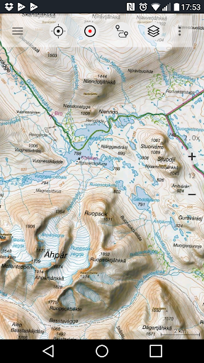
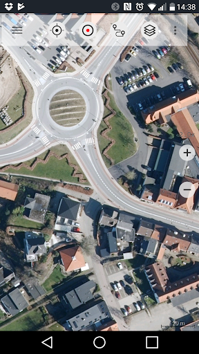
Are you an outdoor enthusiast looking for a reliable GPS navigation app for your adventures in Sweden? Look no further than Sweden Topo Maps! This app provides access to topographic maps and satellite images, giving you all the tools you need to explore the Swedish wilderness.
Main Features:
- Create and edit Waypoints
- GoTo-Waypoint-Navigation
- Track Recording with speed, elevation, and accuracy profile
- Customizable datafields in Map View and Tripmaster
- Share Waypoints, Tracks, or Routes
- Display coordinates in various formats
- Record and share tracks with statistics
- Rotate map and get elevation/distance info
Pro Features:
- Offline Use with no cell coverage needed
- Bulk-download of map tiles for offline usage
- Create and edit Routes
- Route-Navigation for point-to-point navigation
- Import/Export Waypoints and Tracks
- Additional Map Tile-Server options
- No Ads for uninterrupted navigation
With Sweden Topo Maps, you can enjoy activities like hiking, biking, camping, skiing, and more without worrying about cell coverage. The app allows you to add custom waypoints, import/export routes, and preload map data for areas without service.
Download Sweden Topo Maps for FREE on SoftPas and start exploring the stunning landscapes of Sweden with confidence!
User Reviews for Sweden Topo Maps 1
-
for Sweden Topo Maps
Sweden Topo Maps provides comprehensive mapping options akin to Garmin/Magellan GPS handhelds. Pro features enable offline navigation in remote areas.