

Description
US Topo Maps
Explore the Great Outdoors with US Topo Maps
Experience the Best Mapping Solution
US Topo Maps is a user-friendly outdoor navigation app that offers free access to top-quality maps and aerial imagery for the USA.
Main Features:
- Download map data for offline usage
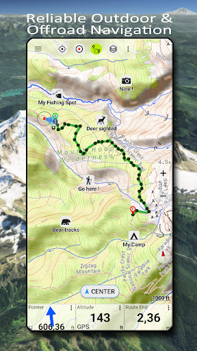
- Measure paths and areas
- Create and edit Waypoints
- GoTo-Waypoint-Navigation
- Create and edit Routes
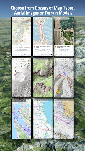
Available Basemap Layers for USA:
- USGS National Map Topo
- USGS National Map Imagery
- USGS NAIP HiRes Imagery
Worldwide Basemap Layers:
- OpenStreetMaps (5 different map layouts)
- Google Maps (Satellite images, Road- and Terrain-Map)
- Bing Maps (Satellite images, Road-Map)
Add Maps from Other Sources:
- Import raster maps in GeoPDF, GeoTiff, MBTiles or Ozi formats
- Add web mapping services like WMS or WMTS/Tileserver
US Topo Maps also allows you to add custom waypoints in various formats and import/export/share GPS data easily.
Plan Your Outdoor Adventures
Whether you are hiking, camping, skiing, or simply exploring new trails, US Topo Maps is your ideal companion.
Download US Topo Maps now and start your journey into the wilderness with confidence!
User Reviews for US Topo Maps 1
-
for US Topo Maps
US Topo Maps is a must-have for outdoor enthusiasts. With a wide range of map layers and offline capabilities, it's perfect for hiking, biking, and more.