

Description
USA Photo Maps
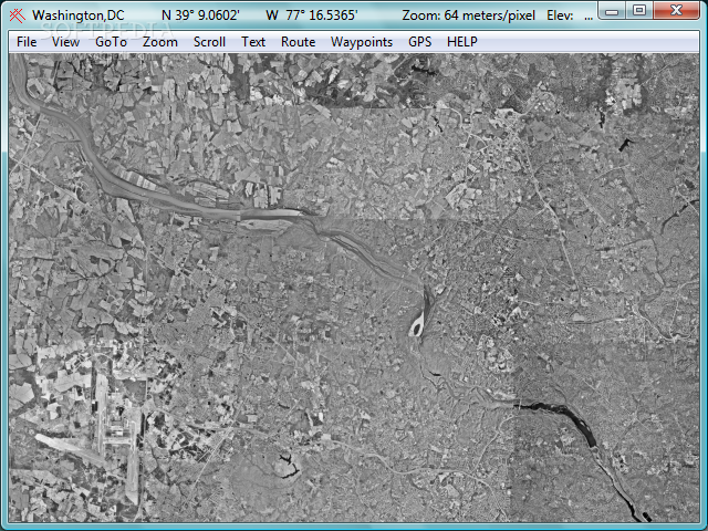
Looking for a reliable application to grab USGS aerial photos, save them, and create GPS maps effortlessly? Look no further than USA Photo Maps! Developed by Doug Cox, this small Windows application offers a clean interface and robust features to meet your mapping needs.
Key Features:
- Download maps by specifying a name and coordinates
- Import data from XML, HST, TCX, or GPX
- Select map type (black and white, colored areas, topographical)
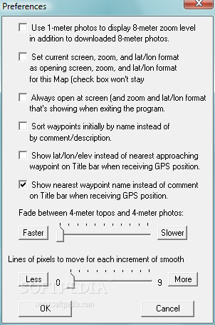
- Adjust brightness and activate UTM grid
- Insert waypoints and create routes
Additional Features:
- Explore specified addresses and populated places
- View locations using latitude and longitude
- Zoom in/out of maps for detailed inspection
- Print high-quality maps with ease
During testing, we found that USA Photo Maps excels in downloading maps quickly and accurately, without taxing your system's resources. Whether you're a beginner or a professional, this application delivers exceptional image quality for all your mapping projects.
Don't let subpar mapping tools hold you back. Try USA Photo Maps today for FREE and start creating detailed GPS maps effortlessly!
User Reviews for USA Photo Maps 1
-
for USA Photo Maps
USA Photo Maps is a reliable app for downloading USGS aerial photos and creating GPS maps. It offers good image quality and user-friendly interface.